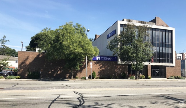
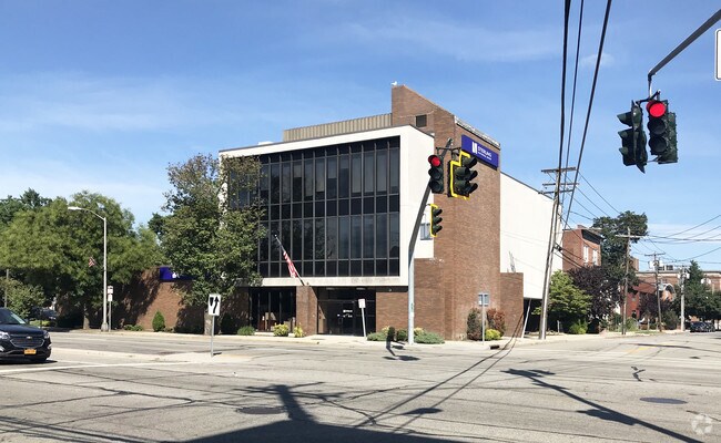
Property Record
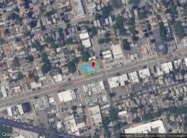
155 Jericho Tpke, Floral Park, NY 11001
NEARBY LISTINGS FOR SALE OR LEASE
Property Detail
155 Jericho Tpke
2259-08-055-00-0041-0
LOTS 41-2,44,110,223,225,229-31,235 TOWN #2 SCH DIST 122
Financialbuilding
Nassau
X
New York
36059C0205G
41
2025
0.48 AC
2025
Western Nassau
302600
Long Island (New York)
6,980 SF
Nassau County-Suffolk County, NY
DEMOGRAPHICS near 155 Jericho Tpke
1 Mile
3 Mile
5 Mile
2024 Total Population
38,510
290,500
794,657
2029 Population
36,756
275,820
756,436
Pop Growth 2024-2029
(4.55%)
(5.05%)
(4.81%)
Average Age
43
43
42
2024 Total Households
12,528
93,903
258,668
HH Growth 2024-2029
(4.79%)
(5.39%)
(5.05%)
Median Household Inc
$123,465
$109,453
$102,575
Avg Household Size
3.00
3.00
2.90
2024 Avg HH Vehicles
2.00
2.00
2.00
Median Home Value
$728,659
$684,288
$700,801
Median Year Built
1948
1951
1952
Nearby Places
- Restaurants
- Banks
- Shops
- Fitness
- Groceries
PUBLIC TRANSPORTATION
COMMUTER RAIL
Floral Park Station (Hempstead Branch - Long Island Rail Road)
DRIVE
WALK
Distance
Floral Park Station (Hempstead Branch - Long Island Rail Road)
2 min
9 min
0.5 mi
Bellerose Station (Hempstead Branch - Long Island Rail Road)
DRIVE
WALK
Distance
Bellerose Station (Hempstead Branch - Long Island Rail Road)
3 min
18 min
0.9 mi
AIRPORT
John F Kennedy International
DRIVE
WALK
Distance
John F Kennedy International
18 min
10.3 mi
LaGuardia
DRIVE
WALK
Distance
LaGuardia
20 min
11.9 mi
Westchester County
DRIVE
WALK
Distance
Westchester County
49 min
33.4 mi
Freight Ports
NY - Red Hook Container Terminal
DRIVE
WALK
Distance
NY - Red Hook Container Terminal
31 min
20.0 mi
Nearby Properties
Address
Land Use
TOTAL SIZE
Lot Size
Zoning
Address
Land Use
TOTAL SIZE
Lot Size
Zoning
7,975 SF
133 AC
PARK
Address
Land Use
TOTAL SIZE
Lot Size
Zoning
1,667,567 SF
30 AC
R3-2
Address
Land Use
TOTAL SIZE
Lot Size
Zoning
986,724 SF
89.79 AC
R3-2
Address
Land Use
TOTAL SIZE
Lot Size
Zoning
800 SF
104.61 AC
PARK
Address
Land Use
TOTAL SIZE
Lot Size
Zoning
202,459 SF
82.16 AC
R3-2
Address
Land Use
TOTAL SIZE
Lot Size
Zoning
448,500 SF
22.59 AC
R3-2
Address
Land Use
TOTAL SIZE
Lot Size
Zoning
636,219 SF
11.39 AC
R3-2
Address
Land Use
TOTAL SIZE
Lot Size
Zoning
900 SF
86.35 AC
PARK
Address
Land Use
TOTAL SIZE
Lot Size
Zoning
1,800 SF
54.60 AC
PARK
Address
Land Use
TOTAL SIZE
Lot Size
Zoning
201,770 SF
7.09 AC
R3-2
Address
Land Use
TOTAL SIZE
Lot Size
Zoning
268,500 SF
27.50 AC
R4
Address
Land Use
TOTAL SIZE
Lot Size
Zoning
32,000 SF
50 AC
PARK
Address
Land Use
TOTAL SIZE
Lot Size
Zoning
344,292 SF
12.56 AC
R4
Address
Land Use
TOTAL SIZE
Lot Size
Zoning
7,030 SF
12.43 AC
R3-2
Address
Land Use
TOTAL SIZE
Lot Size
Zoning
95.36 AC
PARK
Address
Land Use
TOTAL SIZE
Lot Size
Zoning
111,122 SF
8.94 AC
R3-2
Address
Land Use
TOTAL SIZE
Lot Size
Zoning
123,832 SF
5.29 AC
R3-2
Address
Land Use
TOTAL SIZE
Lot Size
Zoning
231,865 SF
9.99 AC
C4-1
Address
Land Use
TOTAL SIZE
Lot Size
Zoning
356,093 SF
3 AC
R3-2
Address
Land Use
TOTAL SIZE
Lot Size
Zoning
171,000 SF
2.76 AC
R2A
Address
Land Use
TOTAL SIZE
Lot Size
Zoning
99,814 SF
1.31 AC
R3-2
Address
Land Use
TOTAL SIZE
Lot Size
Zoning
185,328 SF
2.69 AC
R5
Address
Land Use
TOTAL SIZE
Lot Size
Zoning
142,000 SF
2.38 AC
R3-2
Address
Land Use
TOTAL SIZE
Lot Size
Zoning
161,500 SF
3.44 AC
R3-2
Address
Land Use
TOTAL SIZE
Lot Size
Zoning
252,665 SF
7.50 AC
R3-2
Address
Land Use
TOTAL SIZE
Lot Size
Zoning
224,106 SF
6.72 AC
M1-1
Address
Land Use
TOTAL SIZE
Lot Size
Zoning
123,648 SF
2.76 AC
R2A
Address
Land Use
TOTAL SIZE
Lot Size
Zoning
170,000 SF
4.02 AC
R3-2
Address
Land Use
TOTAL SIZE
Lot Size
Zoning
43,190 SF
6.64 AC
R3-2
Address
Land Use
TOTAL SIZE
Lot Size
Zoning
114,000 SF
4.36 AC
R3-2
The World's #1 Commercial Real Estate Marketplace
Connect with us
© 2025 CoStar Group
The information above has been obtained from sources believed reliable. While we do not doubt its accuracy we have not verified it and make no guarantee, warranty or representation about it. It is your responsibility to independently confirm its accuracy and completeness. Any projections, opinions, assumptions, or estimates used are for example only and do not represent the current or future performance of the property. The value of this transaction to you depends on tax and other factors which should be evaluated by your tax, financial, and legal advisors. You and your advisors should conduct a careful, independent investigation of the property to determine to your satisfaction the suitability of the property for your needs.